

OvitalMap is a cross-platform map browser developed by Beijing Ovital Software Co.,Ltd. Powerful design capabilities and geographic information presentation technology to meet the needs of geographic information planning in all walks of life.
OvitalMap has the following features:
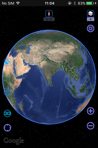
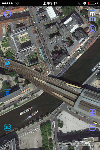
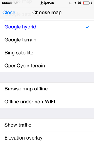
1. Map and elevation
Browse online maps, add custom maps, support SRTM3、ASTER-GDEM2 global elevation data, and combine satellite maps and elevation data to automatically render in 3D. Contour lines can be displayed on the map, so that you can intuitively understand the altitude information when viewing the satellite map.
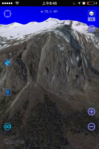
2. BIM and Realistic 3D
Support the loading of large and super-large oblique photography and BIM model data, support the construction of city-level and component-level realistic 3D, smooth operation without stagnation, and support the tree topology management of 3D model data.
3. Field survey and map planning
Ovitalmap provides you with common tools for planning and designing. You can directly edit points, lines and graphics on the map, and add additional information such as charts, photos, videos, etc. to facilitate field survey and data collection.
4. Location and track sharing
Location and track record, you can share your walking track with your friends; The built-in instant messaging function supports text, voice, file and other messages.
5. Enterprise deployment
Support the unified management of enterprise-end data, authority control, operation audit, remote command, and multi-person cooperation, which can be deployed in the intranet and private network.
6. Support AutoCAD documentation
Support the import of CAD design files and display your design on the map; You can also directly convert pictures and Ovitalmap objects into CAD underlays and vector objects, so that you can further make fine design on CAD.
7. Convenient, fast and scalable
The humanized design supports fast data migration between devices/users, is safe and reliable, and supports close data synchronization between devices without network. Plug-in is supported, and software functions are highly scalable.
8. Cross-platform
It fully supports mainstream platforms such as PCs and mobile phones. Your various geographical planning and design on your PC can be quickly synchronized to your mobile phone, and the data collected on the mobile terminal can also be quickly synchronized to your computer.
-----------------------------------------------------------
Continued use of GPS running in the background can dramatically decrease battery life.